-
 ×
× - Startseite
- Kunstdrucke ▸
- Künstler ▸
- Kategorien ▸
- Kunststile ▸
- Bilderrahmen ▸
- Druckmedien ▸
- Alle Druckmedien
- Leinwand Leonardo (Satin)
- Leinwand Salvador (Matt)
- Leinwand Raphael (Matt)
- FineArt Foto Matt
- FineArt Foto Satin
- FineArt Foto Baryt
- FineArt Foto Hochglanz
- Aquarellkarton Munch
- Aquarellkarton Renoir
- Aquarellkarton Turner
- Aquarellkarton Dürer
- Natural Line Hemp
- Natural Line Rice
- Kozo White, 110g
- Kozo Natural, 110g
- Inbe White, 125g
- Unryu, 55g
- Bamboo, 110g
- Premio Unryu, 165g
- Murakumo Natural, 42g
- Bizan Natural, 300g
- Bizan White, 300g
- Aluverbund 3mm
- Acrylglas 5mm
- Musterset bestellen
- Welches Druckmedium passt?
Leinwand
Fotopapier
Aquarellkarton
Natural Line
Japanisches Papier
Spezialmedien
Weitere Informationen
- Hilfe & Service ▸
- Kontaktieren Sie uns
- Ihre Kunst verkaufen
- Häufig gestellte Fragen
- Offene Stellen
- Reklamation
- Muster bestellen
- Gutscheine bestellen
- Versandkosten
- Produktionszeit
- Nachhaltigkeit
- Bildrecherche
- Sonderwünsche
- Wer sind wir?
- Preispolitik
- Firmenpolitik
- Qualitätsversprechen
- Auszeichnungen
- Keilrahmen
- Passepartouts
- Zierrahmen
- Verglasung
- Fillets
- Aufhängungen
- Druckmedien
- Pflegetipps
- Impressum
- AGB
- Datenschutz
- Widerrufsrecht
Info & Service
Weitere Informationen
Wissenswertes
Rechtliches
- Shop ▸
- Kontakt




.jpg)
_-_(MeisterDrucke-1482286).jpg)
.jpg)
 In 3D / AR ansehen
 Bild zu Favoriten hinzufügen
 Wandfarbe ändern
 Bild in einem Raum anzeigen
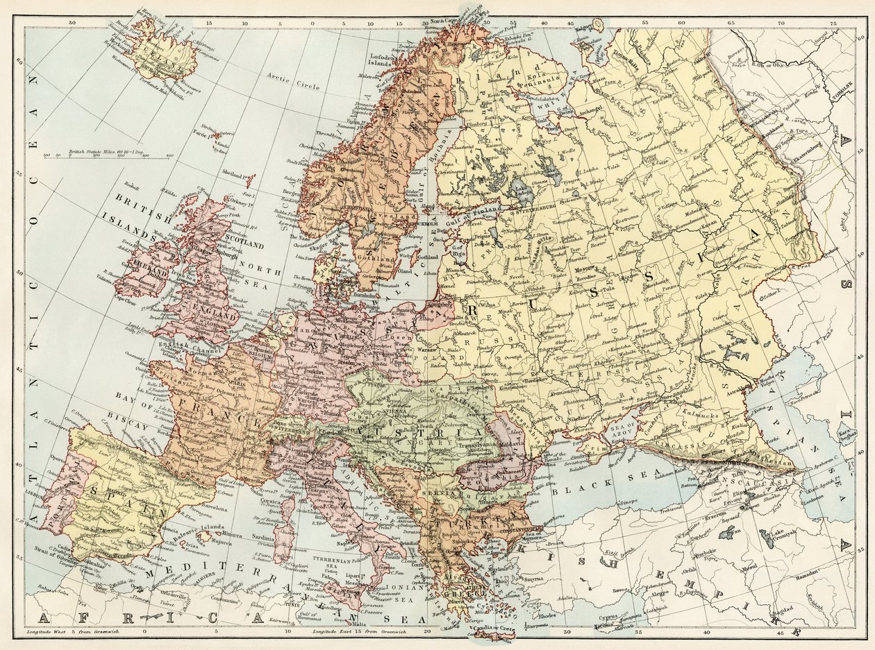
.jpg "Eine kolorierte Europakarte aus dem 19. Jahrhundert, zusammengestellt für den Gebrauch an Hochschulen und Schulen.")
.jpg "Karte von Mitteleuropa, um 1914")
.jpg "Neue universelle Geographie")
.jpg "Europa und der Orient zur Zeit des 3. Kreuzzugs Ende des 13. Jahrhunderts - Karte erstellt von M J-H Schnitzler, Historischer und malerischer Atlas 1858")
.jpg "Modernes Europa")
.jpg "Karte von Europa, ca. 1910")
.jpg "Geografische Karte Europas zur Zeit Napoleons I. In „Atlante Storico Geografico“ von K. von Sruner")
 og vi - (MeisterDrucke-542888).jpg "Die Karte wurde 1823 in Nürnberg bei Christoph Fembo veröffentlicht und zeigt Europa")
_-_(MeisterDrucke-1421446).jpg "Karte Europas im Jahr 1910")
.jpg "Atlas von Europa im Jahr 814: Reiche des Westens und des Ostens. Plan aus dem „Universalatlas der alten und modernen Geographie“ von Vuillemin, ca. 1851")
.jpg "Europa im Jahr 814 - Reiche des Westens und des Ostens - Tafel aus dem „Universalatlas der alten und modernen Geographie für den Gebrauch von Internatsschulen“ von Vuillemin - ca. 1845")
.jpg "Europa nach der Invasion der Barbaren im 6. Jahrhundert - Tafel aus „Universal Atlas of Ancient and Modern Geography for the Use of Residential Schools“ von Vuillemin - ca. 1845")
.jpg "Generalkarte von ganz Europa, unterteilt in seine Hauptländer, 1782")
.jpg "Johnsons Europa, veröffentlicht von Johnson und Ward")
.jpg "Europa")
.jpg "Karte von Europa, 1841")
.jpg "Karte des Deutschen Reiches, 1902")
 - (MeisterDrucke-114274).jpg "Wallis")
.jpg "Andree, Richard. Volkerkarte von Russland. 1881 A")
.jpg "Karte von Europa im Jahr 1743")
.jpg "Europa, aus")
.jpg "Karte von Asien, 1902")
.jpg "Karte von Europa")
.jpg "Karte der antiken Welt, 1902")
.jpg "Das Reich Karls des Großen, aus Atlas Historique et Pittoresque, von M J-H Schnitzler, 1857")
.jpg "Karte von Physikalisch Europa")
.jpg "Karte von Europa, 1821")
.jpg "Detail des Anastasis-Freskos in der Parekklesion der Kirche des Heiligen Erlösers in Chora")
_-_(MeisterDrucke-1427656).jpg "Botanische Tafel, Kartoffelpflanze, Kartoffel (Solanum tuberosum)")
.jpg "Griechische Mythologie: der Schild des Achilleus, Held des Trojanischen Krieges - kolorierter Stich aus dem 19. Jahrhundert - Schild des Achilleus, griechischer Held in den Trojanischen Kriegen - handkolorierter Holzschnitt nach einer Illustration aus dem")
.jpg "Kuppel des Querschiffs: Mosaik „Segnender Christus Pantokrator zwischen Engeln und Erzengeln“, XII. Jahrhundert, Cappella Palatina, Königspalast oder Palazzo dei Normanni (Normannenpalast), Palermo, Sizilien, Italien")
.jpg "Jesus kniet betend im Garten Gethsemane, während ein Engel ihm einen Kelch reicht. Frühes 20. Jahrhundert (Postkarte)")
_and_medicinal_plant_large_astrance_(Astrantia_m_-_(MeisterDrucke-1428052).jpg "Botanische Tafel, giftige und medizinische Pflanze: Große Sterndolde (Astrantia major)")
_resting_in_the_painted_hall_of_the_former_-_(MeisterDrucke-1498586).jpg "Der Leichnam von Horatio Nelson (1758-1805) ruht während der Beisetzung am dritten Tag in der Painted Hall des ehemaligen Royal Naval College in Greenwich; das schwarze Tuch, das den Sarg bedeckt, wird entfernt, und schwarz gekleidete Wachen stehen auf")
_-_Strong_Water_by_William_Clarke_to_illustrate_Medi_-_(MeisterDrucke-1491736).jpg "Balsam-Tanne (Abies balsamea) - Illustration aus „Medical Botanical, Description of the Medicinal Plants of London, Edinburgh and Dublin“ von John Stephenson und James Morss Churchill")
_-_(MeisterDrucke-1483015).jpg "Karte von Paris, Frankreich, aus dem 18. Jahrhundert")
.jpg "Originalpartitur des Wiener Walzers „An der schönen blauen Donau“ von Johann Strauss dem Jüngeren (1825-99)")
_-_(MeisterDrucke-1439303).jpg "Miniaturmalerei, Meherangarh-Fort, Jodhpur, Jodhpur, Rajasthan, Indien, Asien")
_-_(MeisterDrucke-1439544).jpg "Schutzengel (Lithographie, ca. 1920)")
_(1878-1903)_-_(MeisterDrucke-1493711).jpg "Heilige Gemma Galgani von Lucca (Italien) (1878-1903)")
.jpg "Erste Seite der Partitur für vier Celli der Symphonie Nr. 7 in A-Dur, op. 92, von Ludwig van Beethoven")
.jpg "Aufstieg des Heißluftballons \"Martial\"")
.jpg "Hinduracke auf einem Sandelholzzweig, Blatt aus einer von Lady Impey in Auftrag gegebenen Serie, 1779")
.jpg "Das Innere des Palmenhauses, 1832-1833")
.jpg "Mittsommerabend")
.jpg "Konstruktion, 1923")
.jpg "Blühender Garten im Frühling")
.jpg "Blick auf L")
 Water-Lilies - (MeisterDrucke-21577).jpg "Seerosen (»Gelbes Nirwana«)")
.jpg "Zypressenweg unter dem Sternenhimmel")
.jpg "„Erinnere dich“, Serie „Sein Land“, 1924")
_-_(MeisterDrucke-82973).jpg "Ritter, Tod und Teufel, 1513")
.jpg "Blumenvase, 1887")
.jpg "Der pinkelnde Tod")
.jpg "Das Irrlicht")
.jpg "Heuhaufen")
_(for_copy_see_40956)_-_(MeisterDrucke-109648).jpg "Die Heilige Dreifaltigkeit, 1420er Jahre")

 +43 4257 29415
 support@meisterdrucke.com
 Mo-Do: 7:00 - 16:00 | Fr: 7:00 - 13:00